Middle Caicos, Turks & Caicos pictures taken May 10-12, 2007. Includes four panoramas.
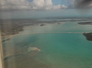
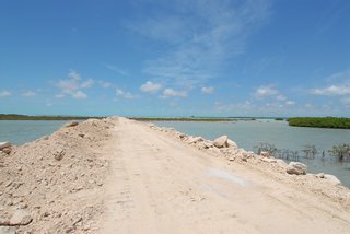
1: The new causeway between North and Middle Caicos. I bicycled across this to get between the two islands.
2: A panorama from outside my bedroom window in the Crosswinds villa [archive.org]. Looking south at 5:10 in the afternoon. The area with houses dotted in the distance is the hamlet of Bambarra.

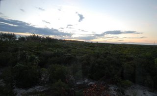
3: Sunrise out of my east bedroom window in the Crosswinds villa at 5:05 a.m. on May 11th.
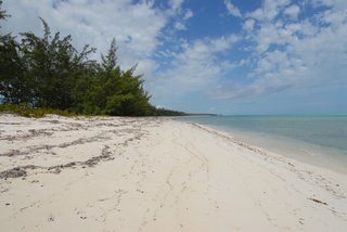
4: The beach in front of the Sundial villa. Looking west.
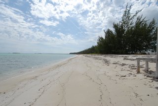
5: The beach in front of the Sundial villa. Looking east.
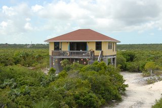
6: The Crosswinds villa. Sitting above the high scrub.
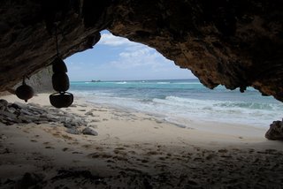
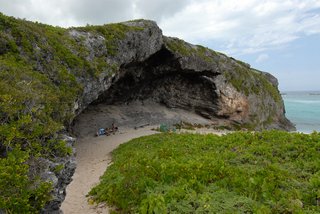
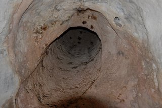
7: The opening of Indian Cave.
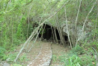
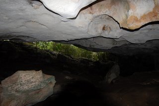
8: The inside of Indian Cave. There are no tunnels here.

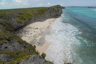
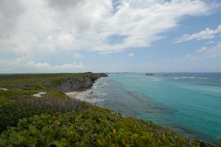
9: Looking down at Norbellis Coves just west of Mudjen Harbour.
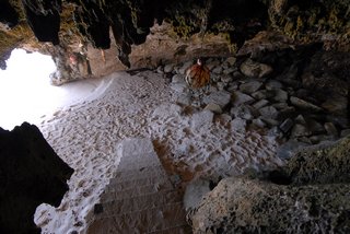
10: The stairs leading down to the beach at the bay just west of Mudjen Harbour.
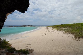
11: Looking out at the bay.
12: Standing on the hill at Mudjen Harbour and looking west at the Norbellis Coves.
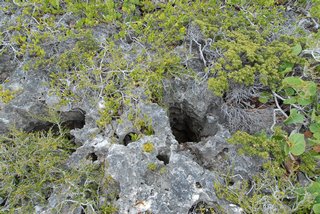
13: This is the limestone one is walking on when not on the paths.
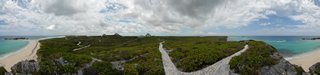
14: A small panorama of Mudjen Harbour. Looking from above.
15: A 360° panorama from the hill at Mudjen Harbour. The buildings dotted about are the cottages and villas of the Blue Horizon Resort, which covers 50 acres.
16: The amphitheatre at Mudjen Harbour Beach. This couple was just finishing up two weeks on Provo. They had been taking day trips to the other islands. This day they hired a boat to bring them here. Then another fellow picked them up in a van and took them to the caves, and then here for a lunch.
17: Looking out from the amphitheatre at Mudjen Harbour Beach. I'm to the couple's left.
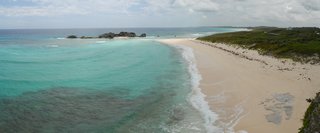
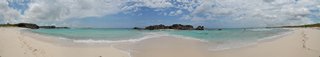
18: A panorama of Mudjen Harbour. Standing on the beach. When the tide is low you can walk out the spit of sand and get to Dragon Cay.
19: I'm now past the spit and looking east. I'll use those stairs to get back.

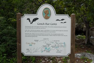
20: The sign for Conch Bar Caves. These limestone caves are the largest in the Caicos Islands. They continue underground for great distances and some believe there are tunnels that reach to the sea. In the 1880's, the caves were mined for "guana" or bat manure. For 10 years, until the supply was exhausted, this "cave earth" was exported overseas where fertilizer was in great demand. During this time, evidence of Lucayan habitation was unearthed. These aboriginal people used the caves as places of worship and as shelters during hurricanes. Artifacts include two wooden stools and some crude bedsteads of forked sticks. To see the map click on the web sized picture and be sure your browser isn't choking the size. They are administered by The Turks & Caicos National Trust.
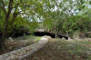
21: Looking at the entrance to Conch Bar Caves. The fellow in the left distance was cutting down the vegetation with a machete. Maybe so tourists can see the entrance to the cave?
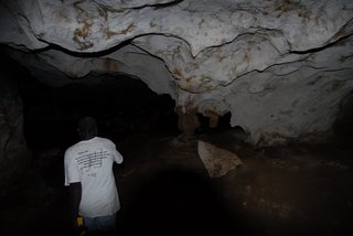
22: Inside Conch Bar Caves. That's the back of Rasta in front of me. He was my guide for the cave. You can read on Rasta's back what Jesus said if you view the original size image.
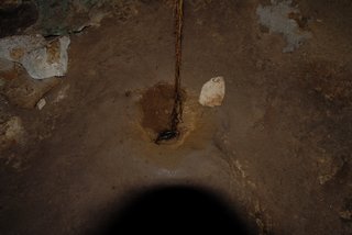
23: Inside Conch Bar Caves. That's a root that has come down through the roof and found water and soil way down below.
24: Inside Conch Bar Caves. Looking up a hole at some sleeping bats.
25: Inside Conch Bar Caves. There is a lot of cave that gets a little natural light.
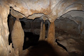
26: Inside Conch Bar Caves. Stalagmites and some stalactites.
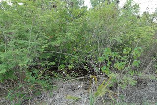
27: An island cotton bush growing wild.
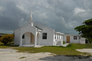
28: The Mt. Moriah Baptist Church. Some fellow on Provo makes the steeples and these churches buy them and plop them on the roof. I thought this one was especially cute.
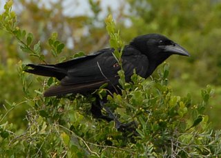
29: A Blackbird I passed, as I bicycled back to Bambarra.
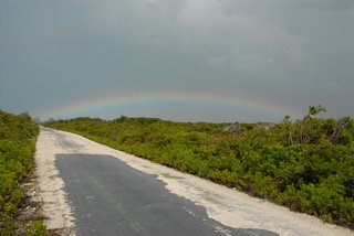
30: The rainbow I was treated to, as I bicycled back to Bambarra. To have any pavement on this road was unusual. The asphalt was so thin that it simply flaked off. In about a year it will be repaved.
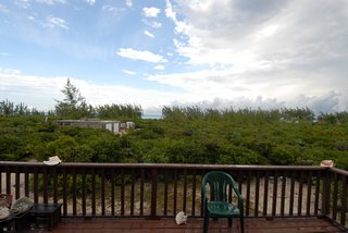
31: Looking at the sea from the front deck of Crosswinds villa at 7:24 a.m. The opening in the Australian pines (casuarina) is now wider. They are non-native weed trees and could all be cut down. The Sundial villa is the red roof near the right edge.
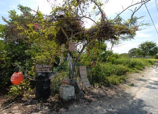
32: There is this fellow in Lorimers that uses a surfboard to go over to other islands and gets the flotsam and brings it back to decorate his yard.
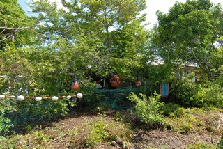
33: Another picture of the yard in Lorimers.
34: The beginning of the new causeway leading to North Caicos.
© Don Wiss 2007-2024. All rights reserved.