Tortola pictures taken in early February 2006. Includes pictures of Beef Island. Pictures of Peter Island are in their own album. Also see corresponding trip journal.
1: A view of West End from the back of the ferry. Taken as I was heading to Jost Van Dyke.

2: A house on Steele Point. Rather precariously placed! Though I hear it has survived a couple hurricanes. Taken as I'm returning to West End from Jost Van Dyke.

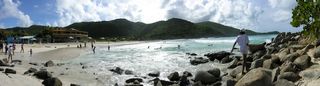
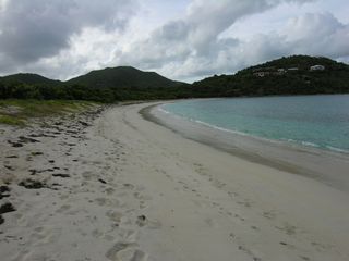
3: Long Bay Beach.

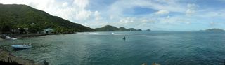
4: Looking out at Jost Van Dyke from Smuggler's Cove.
5: A small panorama of Smuggler's Cove with Gun Point. Having breaking waves in a panorama is problematic.
6: The non-panorama version of the prior picture.
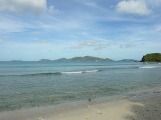
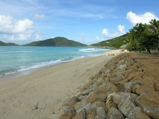
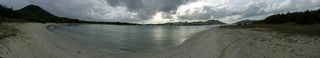
7: Long Bay, looking west. That's Belmont Point sticking up.

8: Long Bay, looking east.
9: Looking down at Long Bay from Lower Bay Point.

10: Apple Bay, looking east. The building you see is Bomba's Surfside Shack. So this may be Cappoons Bay.

11: Apple Bay, looking west.

12: Bomba's Surfside Shack in Cappoons Bay (beside Apple Bay).

13: Bomba's Surfside Shack. This is the back part that is across the road from the bay.

14: Carrot Bay.
15: Cane Garden Bay.
16: Cane Garden Bay.
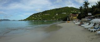
17: Cane Garden Bay.
18: Looking down at Cane Garden Bay.

19: Looking across to Jost Van Dyke.
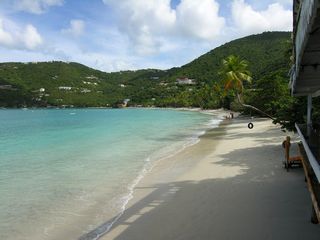
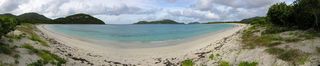
20: The non-panorama version of the beach at Brewer's Bay.

21: The panorama version of the beach at Brewer's Bay.
22: Looking down at Road Town from a stop along the road. All the sailboats rowed up in front are Moorings. Port Purcell is to its left.

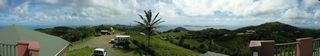
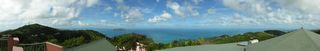
23: A wide panorama taken from above Skytop Restaurant. Looking towards the east.
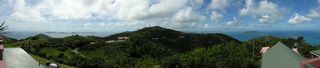
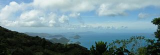
24: Another wide panorama taken from Skytop. Looking towards the north.
25: Another wide panorama taken from Skytop. Looking towards the west.
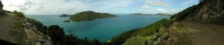
26: Looking down at Sea Cow Bay from along Ridge Road.

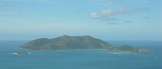
27: A view of Jost Van Dyke from the Sage Mountain North Trail (#1).

28: A view facing west from the Sage Mountain North Trail. In the foreground is Belmont Pond and Belmont Point. Just behind the point is Great Thatch.

29: A wide angle view facing west from the Sage Mountain North Trail.
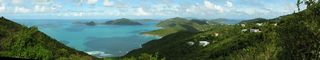
30: A panorama of the island's east end, taken from the scenic lookout on the Sage Mountain Joseph R. O'Neal Trail (#5). The bays in the foreground are Sea Cow and Nanny's Cay.
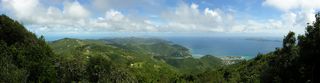
31: Zoomed in on Nanny Cay Marina. Taken from the scenic lookout on the Sage Mountain Joseph R. O'Neal Trail.

32: Another panorama of Sea Cow Bay and Nanny Cay. Taken from the scenic lookout on the Sage Mountain Joseph R. O'Neal Trail.
33: Looking down at Road Town. Taken from a construction site off Ridge Road.

34: Looking down at Road Town from along Ridge Road.

35: A panorama looking at Guana Island from Manchester, Belle Vue along the Ridge Road heading towards East End.
36: A non-panorama of Josiah's Bay

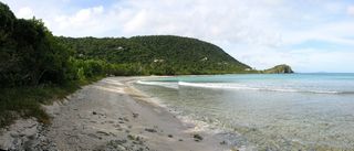
37: A panorama of the beach at Josiah's Bay.
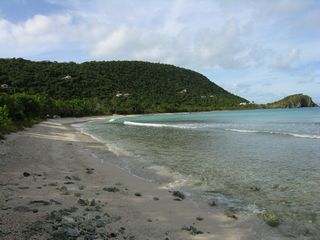
38: The beach at Josiah's Bay. Looking east.

39: The beach at Josiah's Bay with the concession.

40: Lambert Bay and the Lambert Beach Resort.

41: The beach at Lambert Bay. Facing east and standing just beyond the Lambert Beach Resort. To the left is Guana Island.
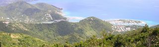
42: Looking east. In the distance is Virgin Gorda. To the left is the airport and Beef Island.

43: A more than 180° panorama of Guana Island. Taken on the road past the prison.
44: A view of Beef Island and its airport.

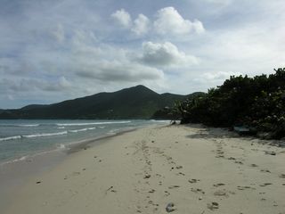
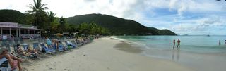
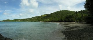
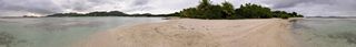
45: The beach at Long Bay on Beef Island. Facing east.

46: The beach at Long Bay on Beef Island. Facing west.
47: A more than 180° panorama of Long Bay on Beef Island.
48: A panorama of Trellis Bay. Facing east.
49: A panorama of Trellis Bay. Taken from Sprat Point and facing west.
50: Trellis Bay. Looking towards Sprat Point.

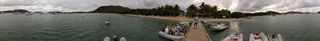
51: A 360° panorama of Trellis Bay taken from the dock in front of the Loose Mongoose. I need to output as multi-layer Tiff and mask out the fellow appearing multiple times.
52: A 360° panorama of Well Bay, on Beef Island.
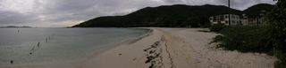
53: The non-panorama version of the beach on the east side Brandywine Bay.

54: A panorama of the beach on the east side of Brandywine Bay.
55: The pool inside the botanic Garden.

56: A lizard inside the botanic garden.

57: The water fountain inside the J.R. O'Neal Botanic Garden.

58: The entrance to the J.R. O'Neal Botanic Garden.

59: The Old Government House. Now a museum.

60: St. George's Anglican Church in Road Town. A survivor of the 18th century, but was rebuilt in the early 19th century following a hurricane.

61: HMS Prison. The walls date back to the 18th century and mark the oldest building in Road Town. It is still a working jail.

62: Dolphin Discovery at Paradise Reef.

63: Trying to get mangroves to grow here again.

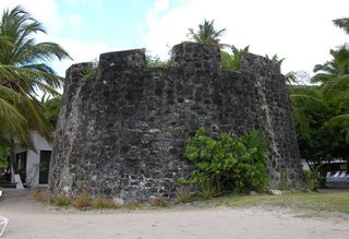
64: The fort at Fort Recovery. Now part of the Fort Recovery Estate Beachfront Villa Resorts. Erected by the Dutch in 1660.
65: A sign I found at Frenchman's Cay Resort.

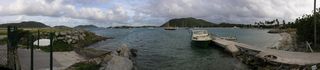
66: Looking at West End from towards Steel Point. My bike makes its appearance. Past the sailboats is Sohper's Hole Marina.

67: The Dungeon. Formally know as Pockwood Pond Fort. Built in 1648 by the Dutch to protect island shipping, it was later rebuilt by the English Royal Engineers. My bike appears again.

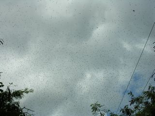
68: Insects swarming overhead at The Dungeon.
69: Ruins of the William Thorton Estate.
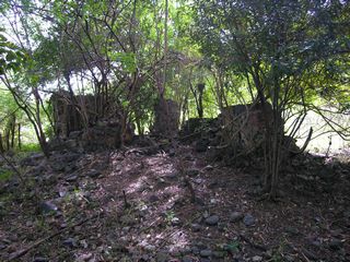
70: Ruins of the William Thorton Estate.

71: The restaurant of The Fort Burt Hotel on top of the remains of Fort Burt.

72: A view of Road Bay. The red roofed building is the Road Town ferry dock.

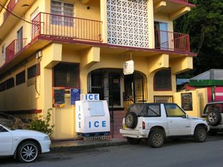
73: The Midtown Restaurant.
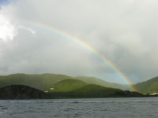
74: A rainbow with Tortola in the background. Seen on the ferry ride returning from Virgin Gorda.

75: The rainbow stuck with us a long time.
76: All the way to Road Town. Pictures continue in the Virgin Gorda album.

© Don Wiss 2006-2024. All rights reserved.